No products in the cart.
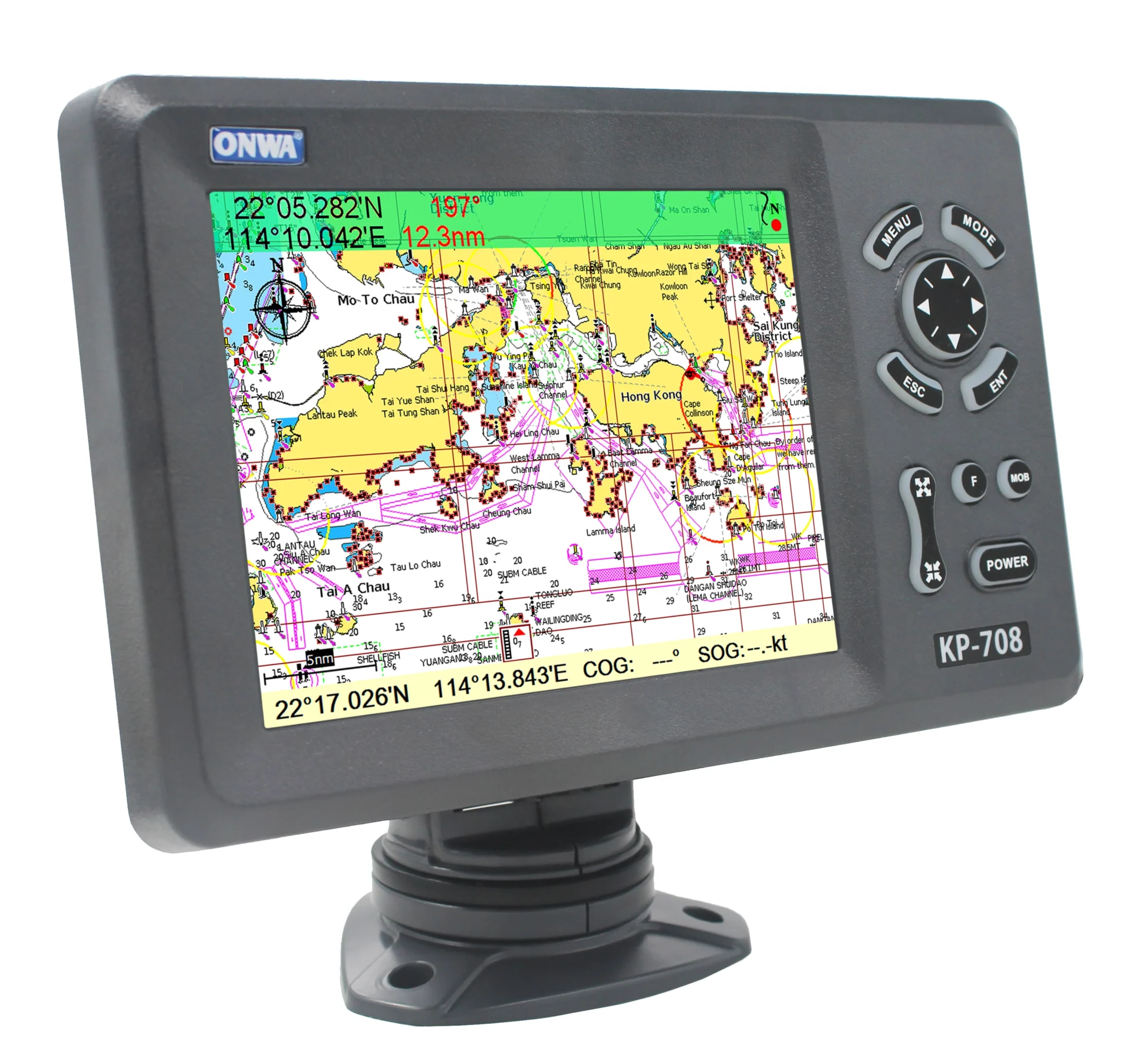
Portable Marine GPS With AIS Device Satellite Transponder Receiver Chart Plotter 7 Inch WIFI KP-708 Beacon Electronics
R9,000 Excl VAT

Find out how...
PayJustNow is a simple, easy-to-use payment system.
Here’s how it works:
PayJustNow allows you to pay for your purchase over 3 equal, zero interest instalments. You’ll pay one instalment at the time of purchase, the next at the beginning of the following month and the last one a month thereafter.
#zerointerest
Step 1:
Browse your favourite online stores and proceed to check-out.
Step 2:
Choose PayJustNow as your payment method.
Step 3:
Create your account as easily as if your eyes were shut (though we’d recommend you keep them open).
Step 4:
Complete your purchase and whoop for joy!
Here’s what you’ll need:
A valid RSA ID document
To be over 18 years old
An email address
A SA Bank issued debit or credit card
Portable marine GPS with AIS device satellite transponder receiver chart plotter 9 inch WIFI KP-708 beacon electronics supply
Product Description
Model: KP -708
7-inch LCD GPS Chart Plotter with Internal GPS Antenna
Features:
- Easy to Operate
- 7-inch high resolution (800×600 pixels ) LCD
- Built -in GPS Antenna , External Antenna can be used as an option
- Supports Dual Mapping System : K-Chart and C-Map
Plotter characteristic
Waypoint/icons: 12000 user waypoints with name, symbol
3 system waypoints: MOB, Start, Cursor
10 proximity waypoints
Routes: Max 30 routes. And up to 170 points for each one
Tracks: 8000 points automatic track log:
10 saved tracks (up to 8000 track points each)
Let you retrace your path in both directions
Alarms: XTE, Anchor drag, arrival speed, voltage, proximity waypoint and time, AIS alarm.
Palette: Normal
Daylight exposed to sunlight
Night in dark environment
NOAA paperchart colors
Tides: Tide data
Projection: Mercator projection
Position format: Degree of minutes and UTM
Base map: Built -in ONWA K -Chart
External Map: SD Cards slot for C -Map MAX and ONWA K -Chart
User data storage: Internal backup of user settings or external SD -card
Plot interval: 5s to 60min 0.01nm to 10nm Automatic way
Plotting scales: 0.001nm to 1000nm
Nav Data: Inputs:
$–GGA. $–GLL. $–GSA. $–GSV
$RMC, $-VTG, $-ZDA. $–VWR
$~VWT. $~MWD. $–VPW
Outputs:
GGA, GLL, RMC, AAM, APA.
APB, BOD, BWC, BWR, DBT
DPT, HDT, MTW, RMBTLL,
VTG, WPL, XTE, ZDA, ZTG,
ZDL, MWD, VPW, VWR, VWT,
Outputs for autopilot:
$–APB, $–BOD, $–XTE, $–APA
Perspective View: Onto/Off
Celestial: Sunrise/Sunset Moonrise/Moonset
Power supply : 10.5 to 35V DC, current drain<1.0A at 12V
PHYSICAL
Size: 243mm (H )X155mm (W )X82mm (D )
Weight: 0 .6 KG
Display: 7 -inches Color TFT day -view LCD
800×600 pixels
Input & Output Port : one opto-isolated input Port
one RS232 Output Port
Waterproofing: Display unit: IPX5
Temperature range : Display Unit : -15℃ to 55℃
Antenna unit : -25℃ to 70℃
| GPS Receiver characteristics | |
| Receiver | 50 parallel channel GPS receiver continuously tracks and uses up to 50 satellites to compute and update your position |
| Acquisition time | Cold start: 60 seconds average |
| Hot start | 45 second average |
| Update rate | 1 /second, continuous |
| Position | 2 .5 meters (95 %) without S /A |
| Velocity | 0 .1 meter /sec without S /A |
| Time | 100ns synchronized to GPS time |
| Dynamics | Altitude: 50 ,000m Max |
| Velocity | 500 m/s |
| Acceleration | 4g Max |
| Datum | WGS 84 and user define |
Equipment list Standard:
1. Display unit
2. Operator manual
3. Installation materials and standard spare parts


Additional information
| Weight | N/A |
|---|---|
| Model Number | KP-708 |


Reviews
There are no reviews yet.