B21, China Town Mall, Midrand

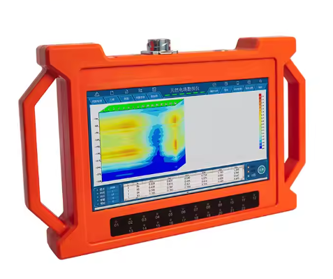
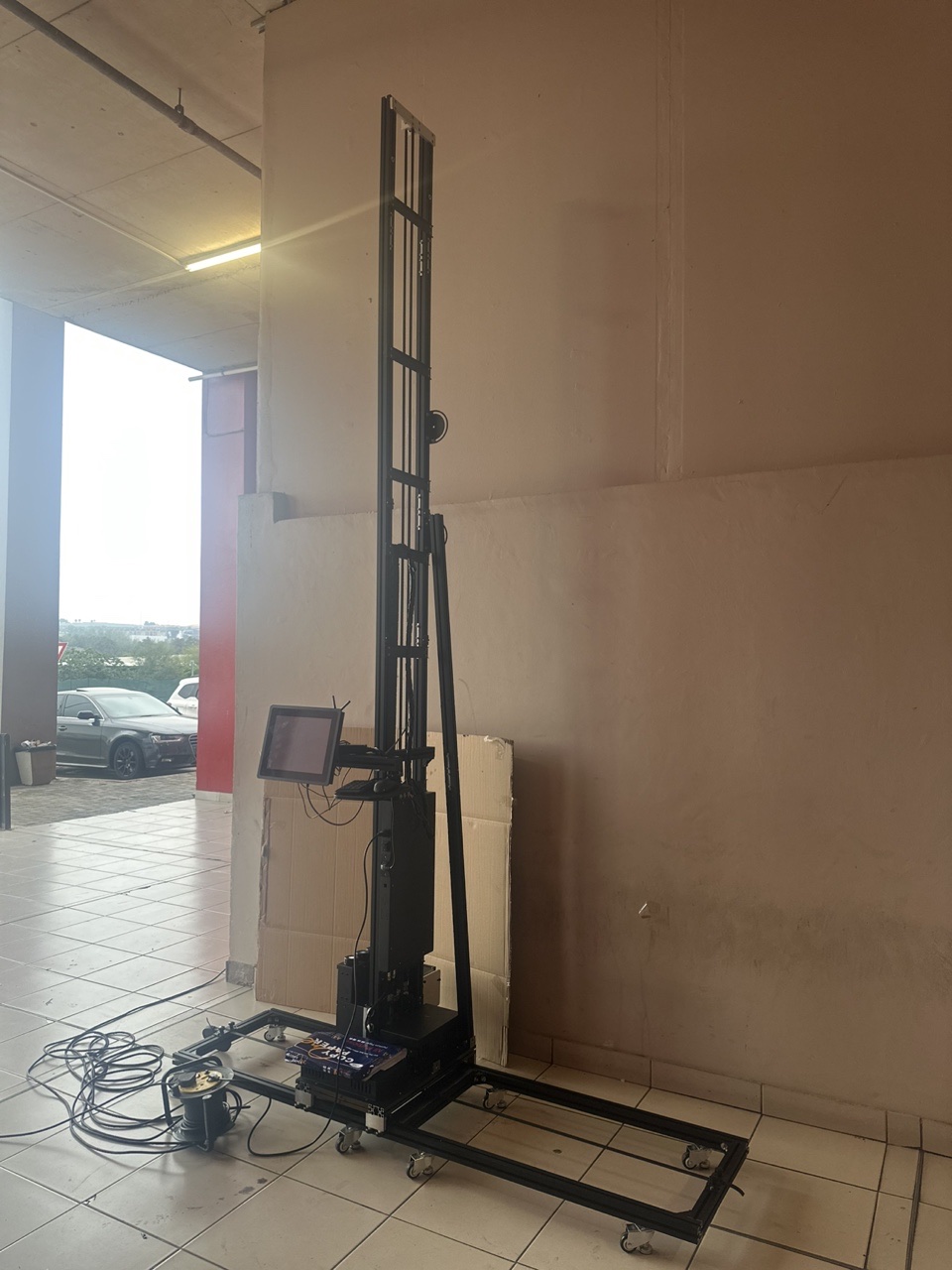
PQWT-GT500A Underground Deep Water Detector with 500m Depth
Asset finance available
Do you want funding for this equipment?
Afrimart can connect you with trusted funding partners who specialise in asset finance for businesses like yours. Compare options and apply in minutes — final approval is subject to provider review.
Check funding options
Secure & no obligation

- Section : Machinery
- Category : Mining Machinery
- SKU : 1600537377189

Product Description
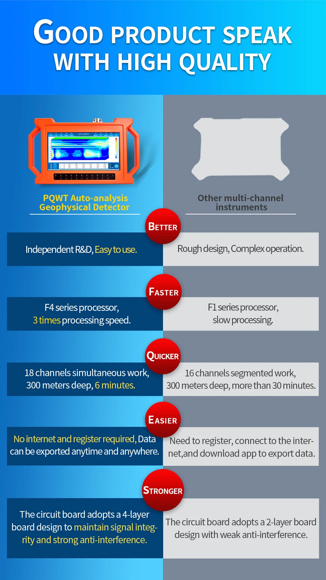
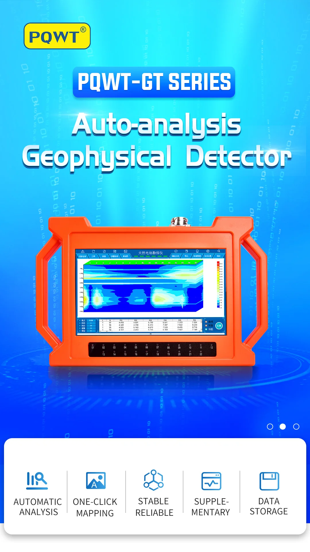
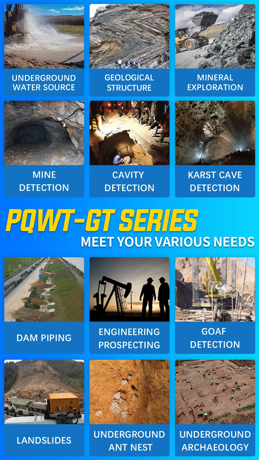
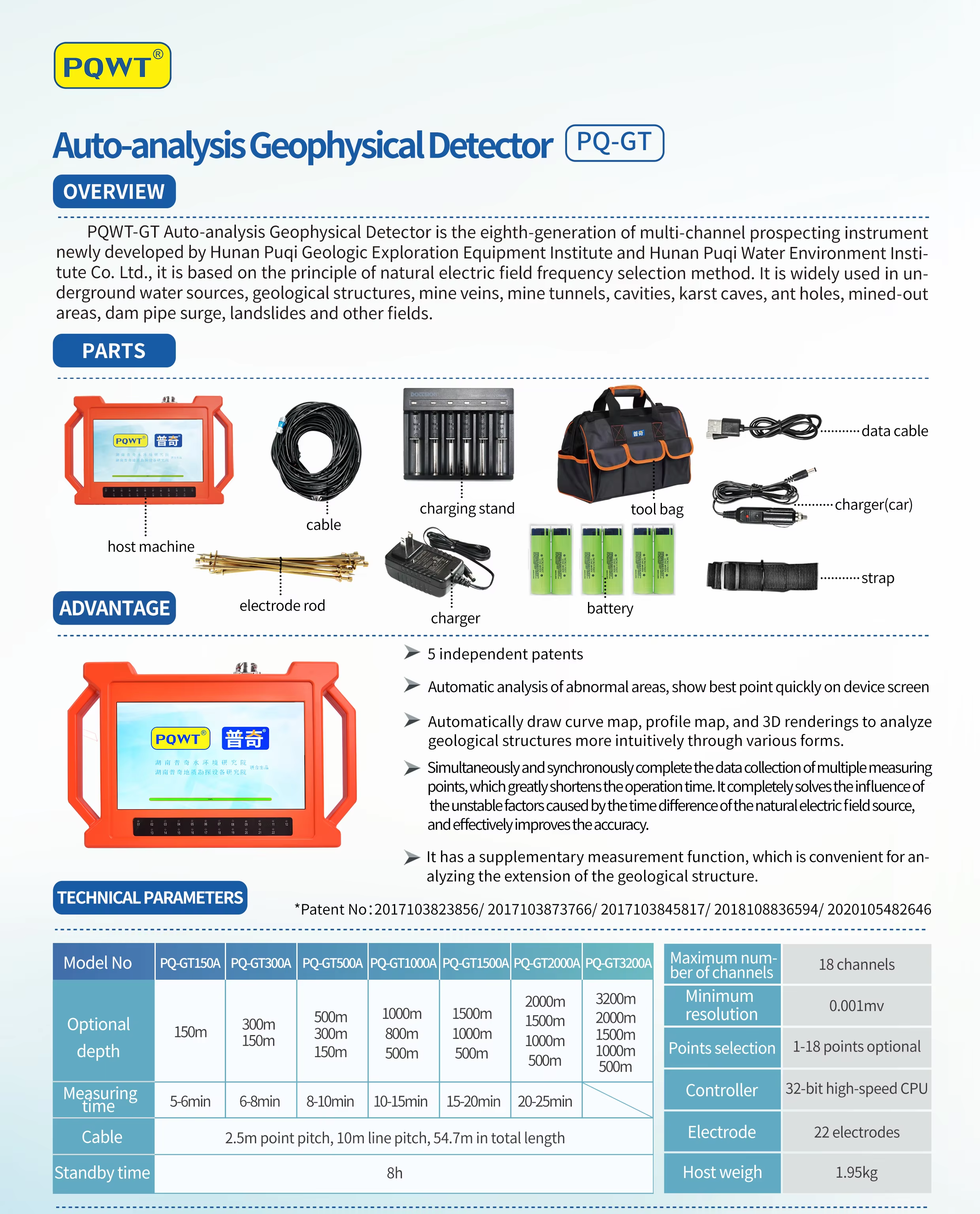
The PQWT-GT Series is the 8th-generation of multi-channel prospecting instrument newly developed by PQWT based on the principle of natural electric field frequency selection method. It is widely used in underground water sources, geological structures, mine veins, mine tunnels, cavities, karst caves, ant holes, mined-out areas, dam pipe surge, landslides and other fields.
PQWT GT series of instruments integrates 5 independent invention patents of PQWT, including data acquisition system, data processing system, automatic mapping system, auxiliary analysis system and circuit system. It realizes the simultaneous data acquisition of multi-channel and multi-frequency, completely solves the influence of unstable factors caused by the time difference of the natural electric field source, and greatly improves the accuracy and work efficiency. The instrument can process the collected data, automatically draw curve map, profile map, and 3D renderings in real time, and automatically analyze abnormal areas, so as to provide scientific basis for analyzing geological structures quickly and effectively.
Product Features Auxiliary Analysis: The instrument analyzes the abnormal area with one click. Automatic Mapping: Automatically draw curve map, profile map, and 3D renderings. Stable and Reliable: Collect 18 points data with one-time wiring. Supplementary Measurement Function: The extension of geological structure can be analyzed by making supplementary measurement in front and rear of the survey line. Data Storage: It can store curve map, profile map, and 3D renderings of more than 999 survey lines to facilitate the production of geophysical exploration reports.
Product Components
① Host machine: Collect and process data.
② Tool bag: Store tools.
③ Electrode rod: Connect the cable and the ground to be tested.
④ Battery: To supply power to the host.
⑤ Cable: Connect the host.
⑥ Charging stand: Charge the battery.
- Shipping Timeframes: All orders are processed within 2-5 business days (excluding weekends and holidays). After your order has been processed, the estimated delivery time is before 01 Oct, 2026, depending on customs, Please note that due to high demand, some items may experience longer shipping times, which will be communicated at order confirmation email.
- Order Processing Time: Please allow 2-5 business days for us to process your order before it is shipped . Orders placed after 16:00 on Fridays, or during weekends and public holidays, will begin processing on the next business day. Processing times may be extended during peak seasons or sales events.
- Manufacturing Time: Some products needs manufacturing time, the manufacturing process will take approximately 10-30 business days depending on the product. This timeframe may vary depending on the complexity of the product and current demand. but this will be communicated with you during order confirmation.
- Returns and Exchanges: We offer a 30-day return policy for most items. If you are not completely satisfied with your purchase, you may return it within 30 days of receipt for a refund or exchange. Items must be unused, in their original packaging, and accompanied by proof of purchase. Return shipping costs are the responsibility of the customer, unless the item was damaged or defective upon arrival.
1. What is the maximum depth the PQWT-GT500A can detect?
The PQWT-GT500A can detect underground water sources and geological structures at depths of up to 500 meters.
2. What technology does the PQWT-GT500A use for detection?
The PQWT-GT500A uses the natural electric field frequency selection method, which is effective for multi-channel prospecting.
3. What are the main applications of the PQWT-GT500A?
It is widely used in detecting underground water sources, geological structures, mine veins, mine tunnels, cavities, karst caves, and more.
4. How does the automatic mapping feature work?
The instrument automatically draws curve maps, profile maps, and 3D renderings based on the collected data in real time.
5. Can the PQWT-GT500A analyze abnormal areas?
Yes, it has an auxiliary analysis feature that allows users to analyze abnormal areas with a single click.
6. How many survey lines can the instrument store?
The PQWT-GT500A can store curve maps, profile maps, and 3D renderings of more than 999 survey lines.
7. What components are included with the PQWT-GT500A?
The package includes the host machine, a tool bag, electrode rods, a battery, a cable, and a charging stand.
8. Is the PQWT-GT500A easy to use for beginners?
Yes, the instrument is designed for ease of use, with automatic features that facilitate operation for both beginners and professionals.
9. How does the supplementary measurement function work?
The supplementary measurement function allows users to analyze the extension of geological structures by taking additional measurements in front and rear of the survey line.
10. What type of battery does the PQWT-GT500A use?
The PQWT-GT500A is powered by a rechargeable battery that provides the necessary power for the host machine.
11. What is the warranty period for the PQWT-GT500A?
Please refer to the manufacturer's warranty policy for specific details on the warranty period for the PQWT-GT500A.
12. How does the data processing system enhance the instrument's performance?
The data processing system enables simultaneous data acquisition from multiple channels and frequencies, improving accuracy and work efficiency.
13. Can the PQWT-GT500A be used in all weather conditions?
While the PQWT-GT500A is designed to be durable, it is recommended to avoid extreme weather conditions to ensure optimal performance.
14. What kind of training is available for using the PQWT-GT500A?
The manufacturer typically offers training sessions and resources to help users understand how to effectively operate the PQWT-GT500A.
15. How long does it take to charge the battery fully?
Charging time may vary, but it usually takes a few hours to fully charge the battery depending on the specific charger used.
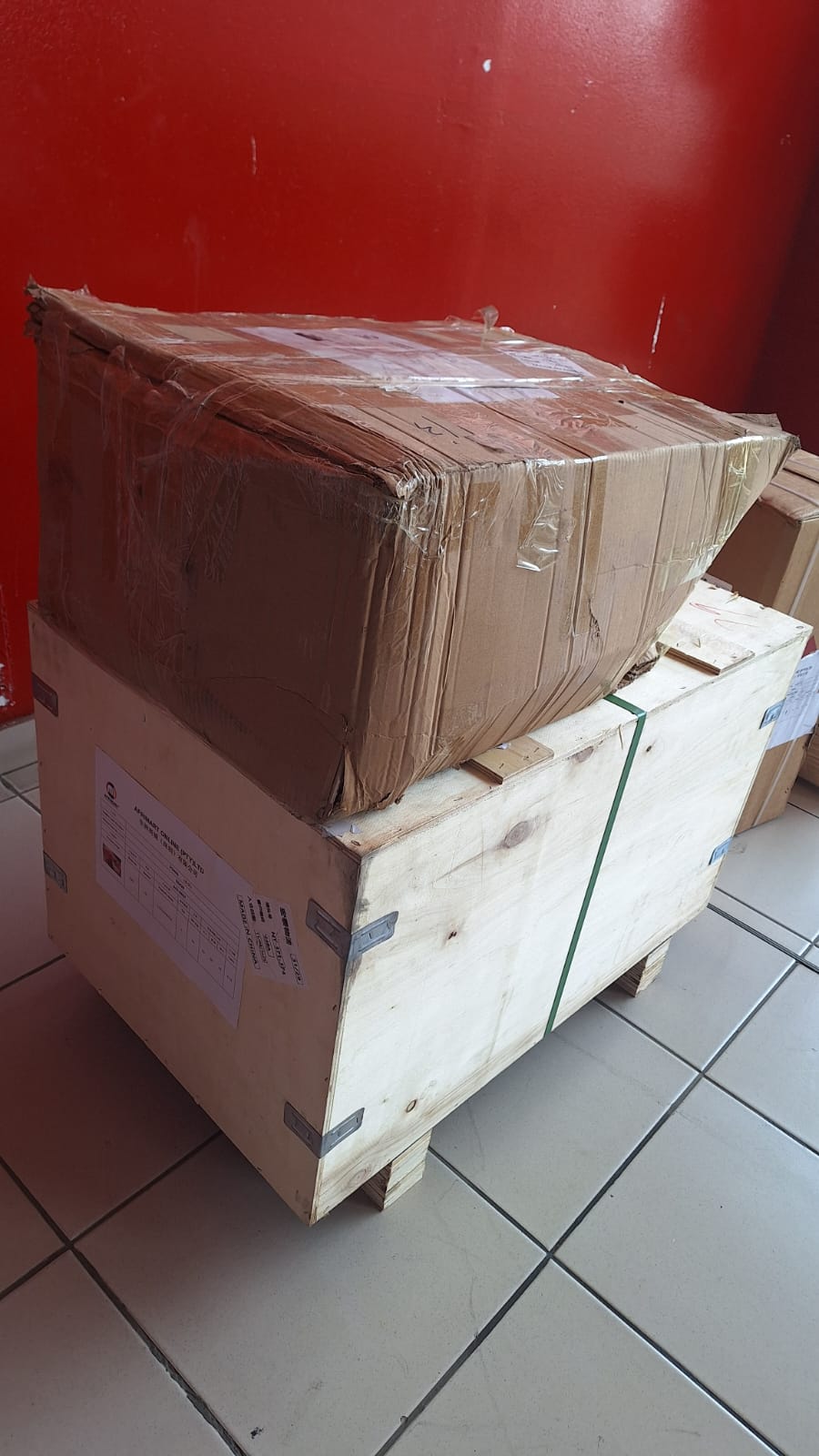
Latest Order Arrivals
Discover our latest orders

12 Heads Embroidery Machine
Toilet Paper Machine Machine

Order Collection
Cross Border Clients
Order cros border countries Collected
Industrial Machine Cllection
Agriculture Processing Machines

Ready for collection

Water Pump Equipment
Packaging Machine and accessories
Fabrics Manufacturing Equipment
Mining Equipments
Food Processing Machine
Batch of Orders
Batch of Orders
Latest Orders Labelled
wheel alignment machines
new arrivals
Pre Orders Offloading
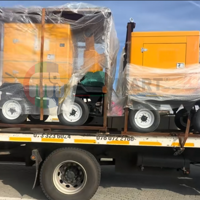
Latest Arrivals
Latest Arrivals
Latest Arrivals
Loading
Toilet paper making machine
Toilet paper making machine
Toilet paper Rewinding Machine
latest arrivals
offloading
order success
order collection
order offloading